The Estuary (Pre-1851)
The Meander
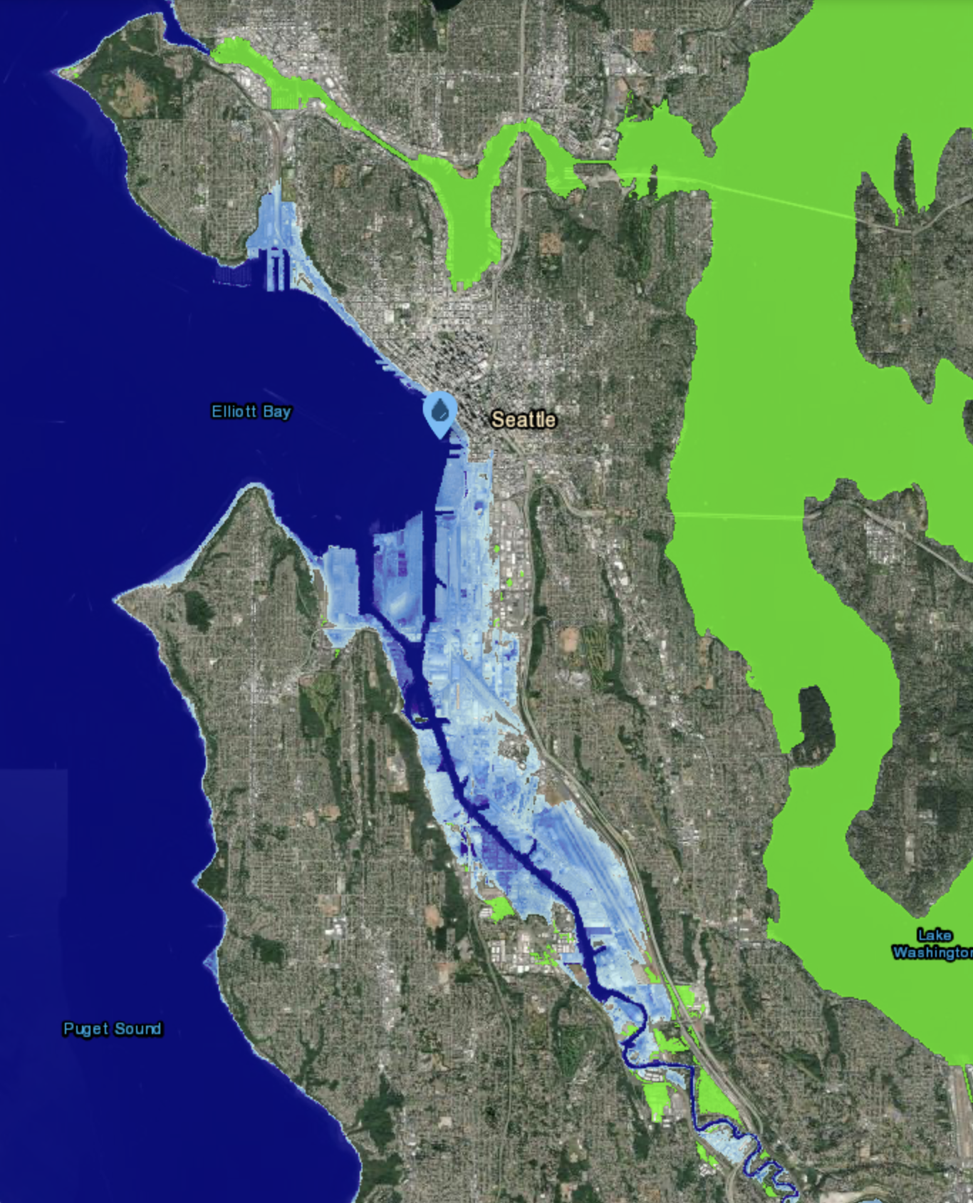
As we gather to imagine the year 2177, we first ground ourselves in the deep history of the Lower Duwamish Estuary. We honor and acknowledge the People of the Inside (Dxwdəwʔabsˇ), who have stewarded the Duwamish River Watershed since time immemorial.
To this day, the river remains their living relative, a source of life and a repository of history that continues to sustain and guide them. Before we begin our journey into the future, we honor the Duwamish Tribe and Coast Salish elders—past, present, and emerging.
Do you carry stories and lived experienced passed down from ancestral landscapes, are you an ancestor, a historian of the Duwamish River Valley pre-1851?
Share them as a gift to the next seven generations.
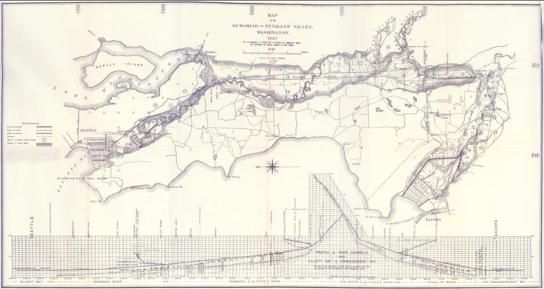
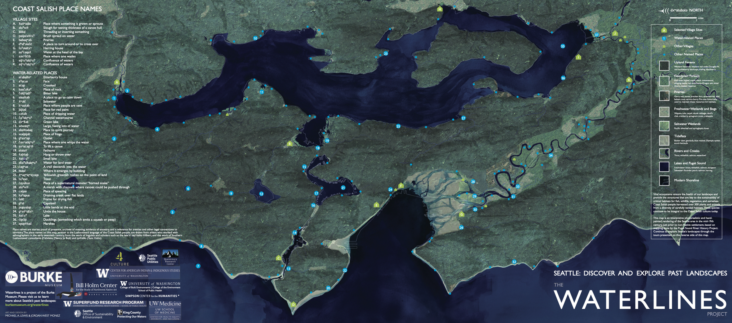
The Waterlines Project, developed in the early 2000s through a collaboration involving the Burke Museum of Natural History and Culture and University of Washington researchers, is a seminal historical and creative endeavor that reconstructs Seattle’s lost landscapes. Its centerpiece—a detailed map of the region circa 1850—reveals the original course of the Duwamish River, the vanished Black River, and the vast tideflats that once defined South Seattle. Led by figures including Amir Sheikh, Donald Fels, and Peter Lape, the project brings together science, art, and history to visualize environmental change from the end of the last ice age to modern urbanization. Learn more here: https://www.burkemuseum.org/collections-and-research/heritage/archaeology/waterlines-project