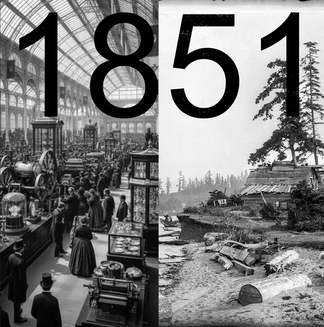
The Industrial Age
(1851–2026)
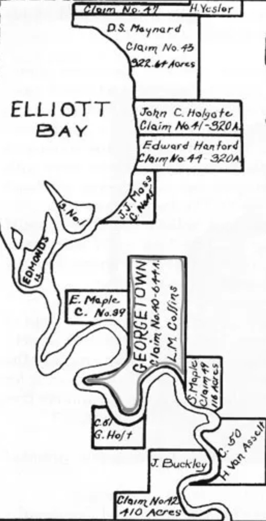
The industrial era is defined by rapid transformation and resource extraction. Beginning with the first colonial land claim in 1851—establishing Georgetown as Seattle’s oldest neighborhood—the People of the Inside (Dxʷdəwʔabš) witnessed their ancestral landscapes reshaped under the forces of Manifest Destiny: politics, religion, and the imposition of private property.
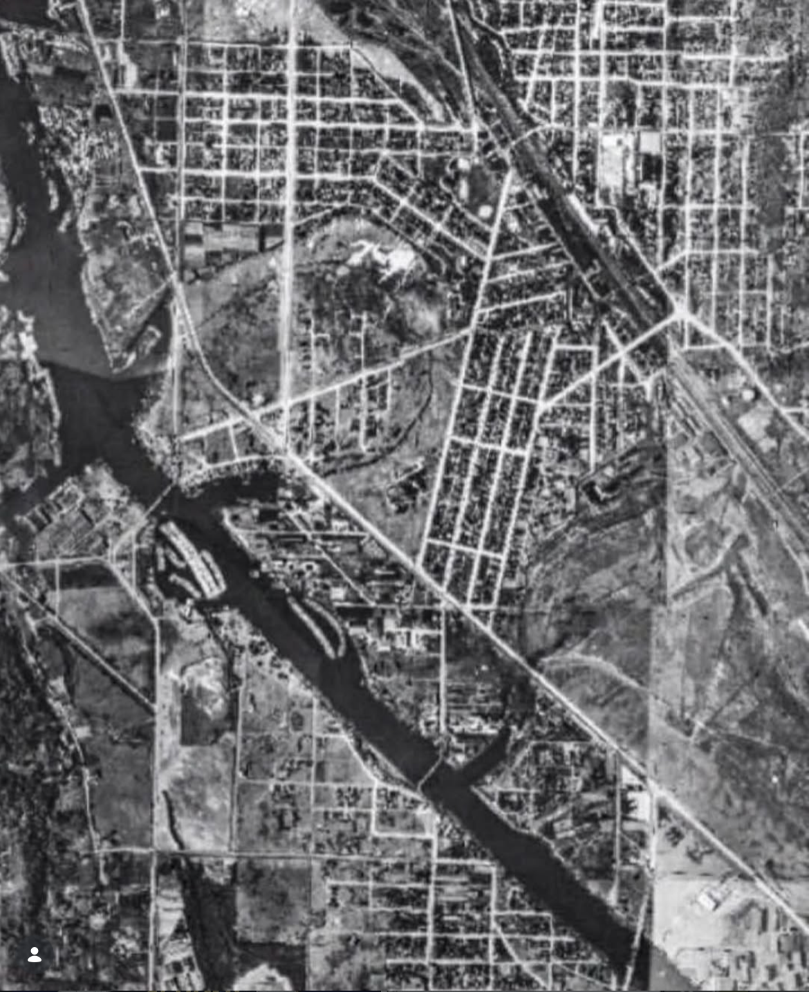
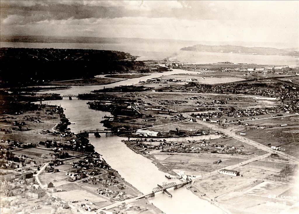
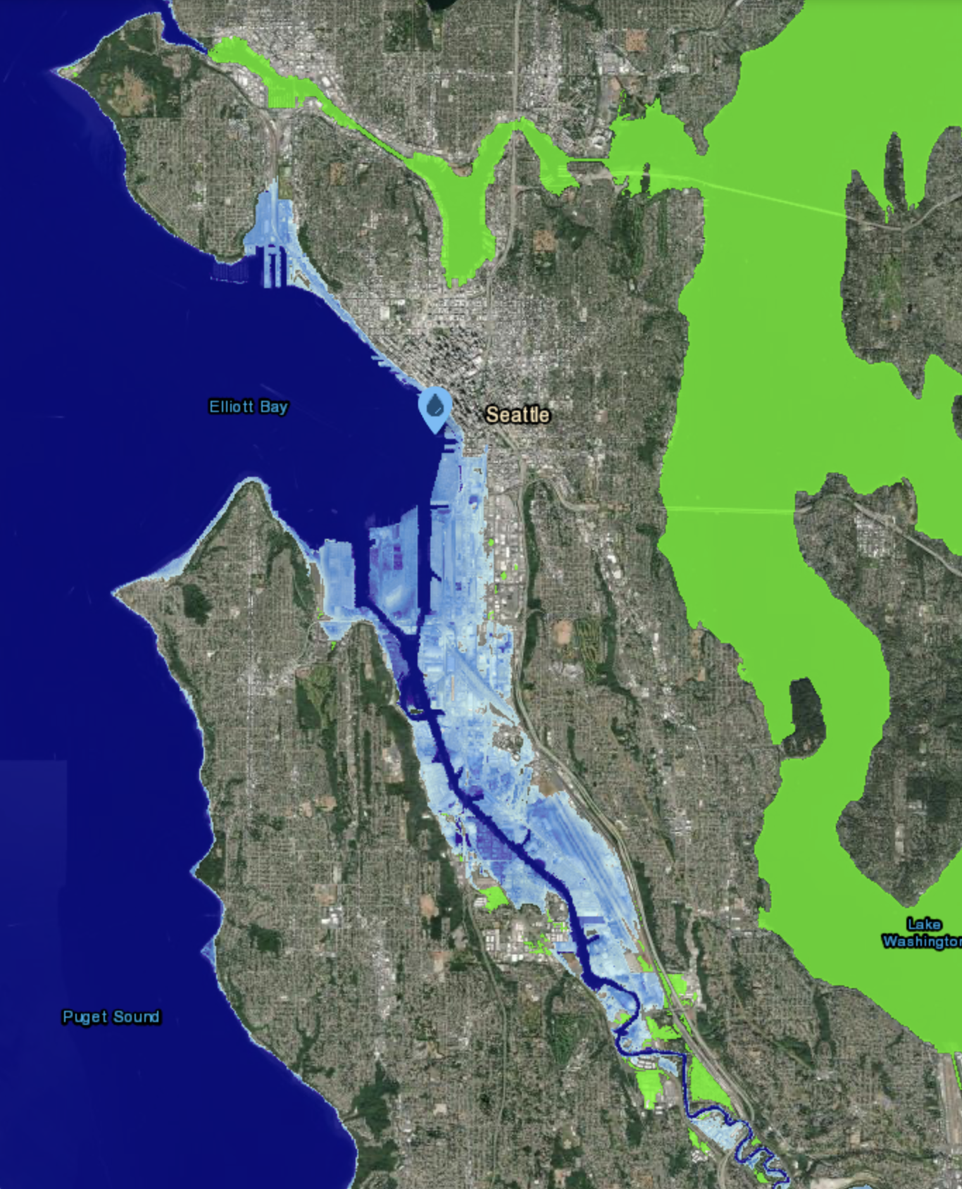
To serve the demands of a new economy, the lower Duwamish watershed was radically altered. The river was systematically straightened and channelized—completed by 1917—to support industrial growth. While this era gave rise to Seattle’s manufacturing core and fueled economic expansion, it also resulted in the loss of 97% of the original wetlands and inflicted deep ecological and cultural harm.
Today, we stand at the threshold of this 175-year chapter, recognizing that the “logic of the machine” has reached its biological and material limits. We now turn toward the work ahead centered on remediation of toxic soil, restoration of damaged ecosystem, and the reimagination of how the lower Duwamish River Valley adapts to a rapidly changing world.
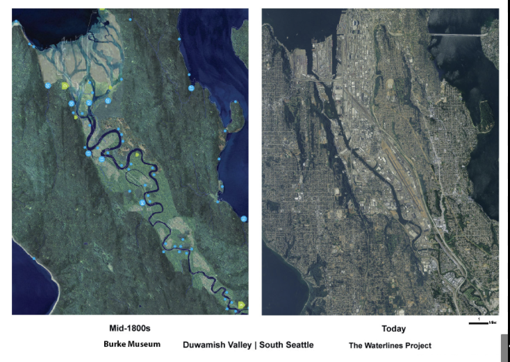
The Waterlines Project map is a powerful visual "X-ray" of the Duwamish River Watershed. It reveals that the rigid, industrial geography we see today is merely a thin crust sitting atop a much deeper, fluid history. For the Duwamish Reimagined narrative, the map serves as the ultimate evidence of why the "Age of Industry" is a temporary interruption of the "Ancestral.
We invite you to share your stories, memories, archival materials, and historic discoveries from this critical period from 1851-2026 that illuminate how the Lower Duwamish River Watershed became what it is today. These contributions may include lived experiences, family histories, photographs, maps, industrial records, ecological observations, or cultural narratives that reveal hidden connections across time.